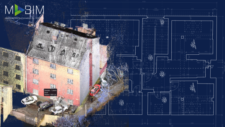
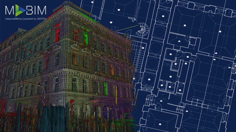
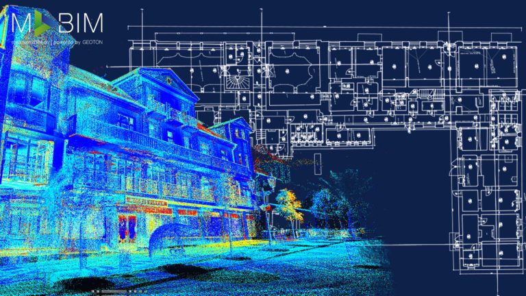
Pointcloud, 360° Photo Viewer, CAD Documentation, 3D Textured model (Mesh), Orthophoto
accuracy
2mm Pointcloud
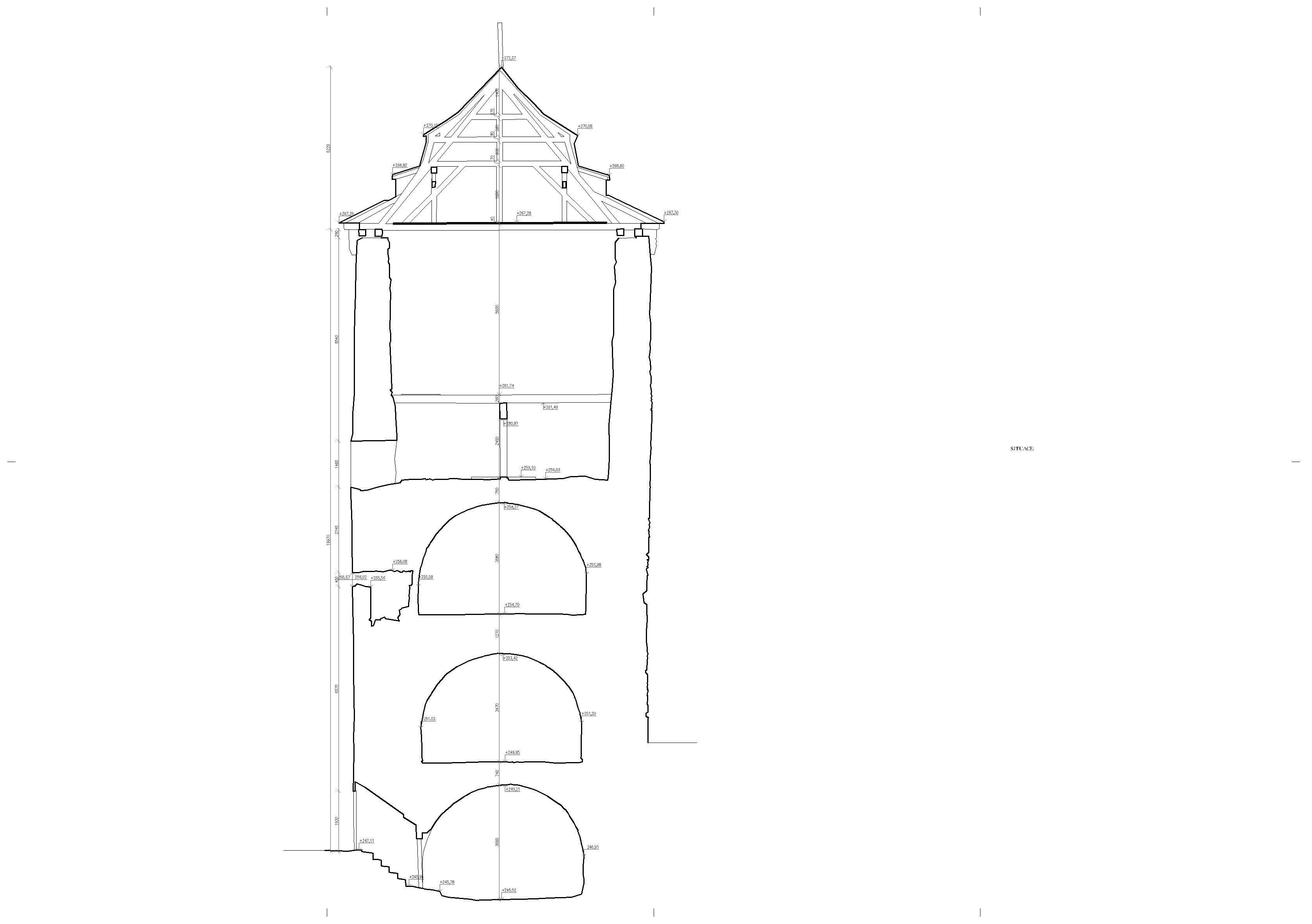
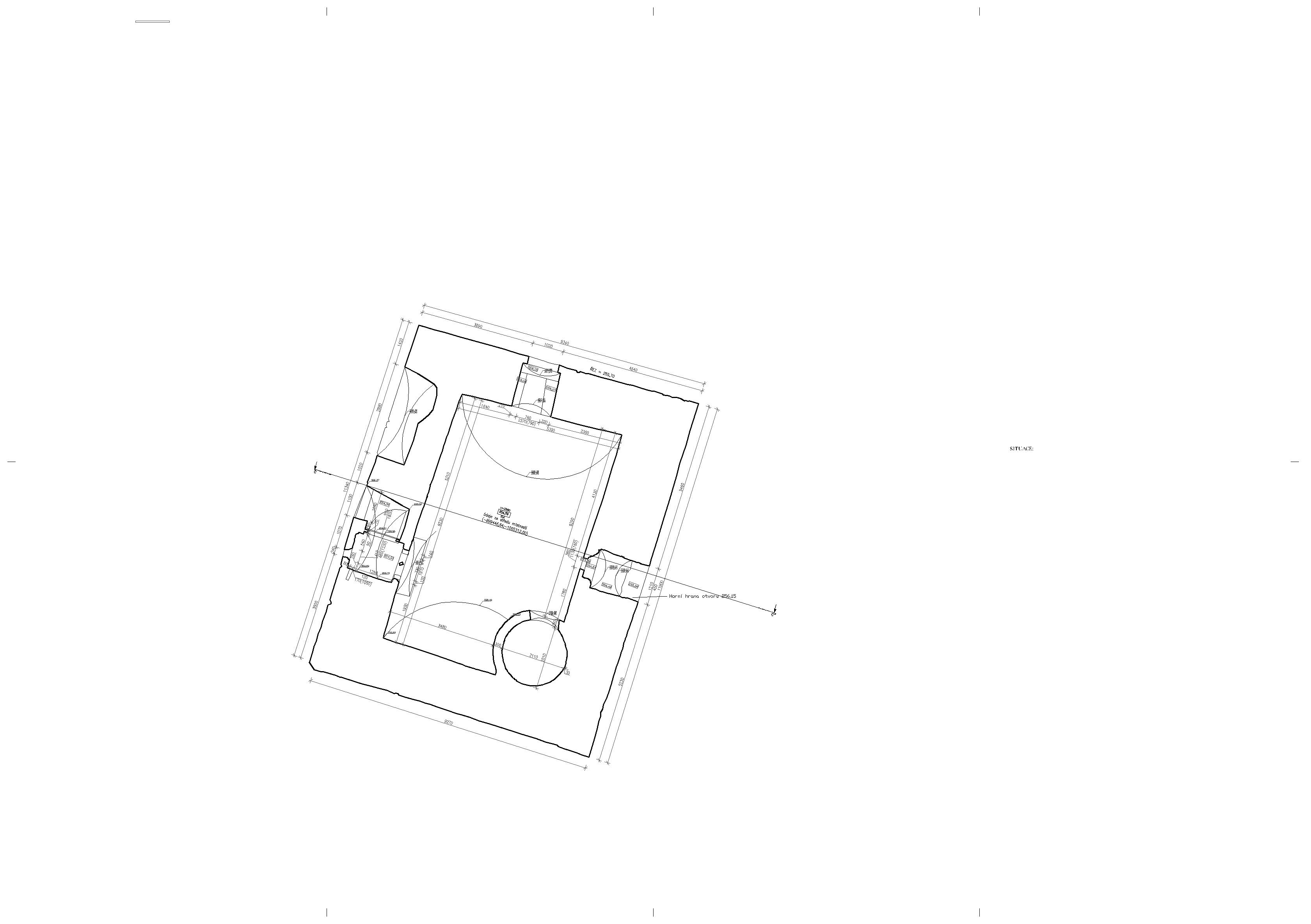
20mm CAD Documentation
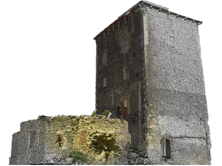
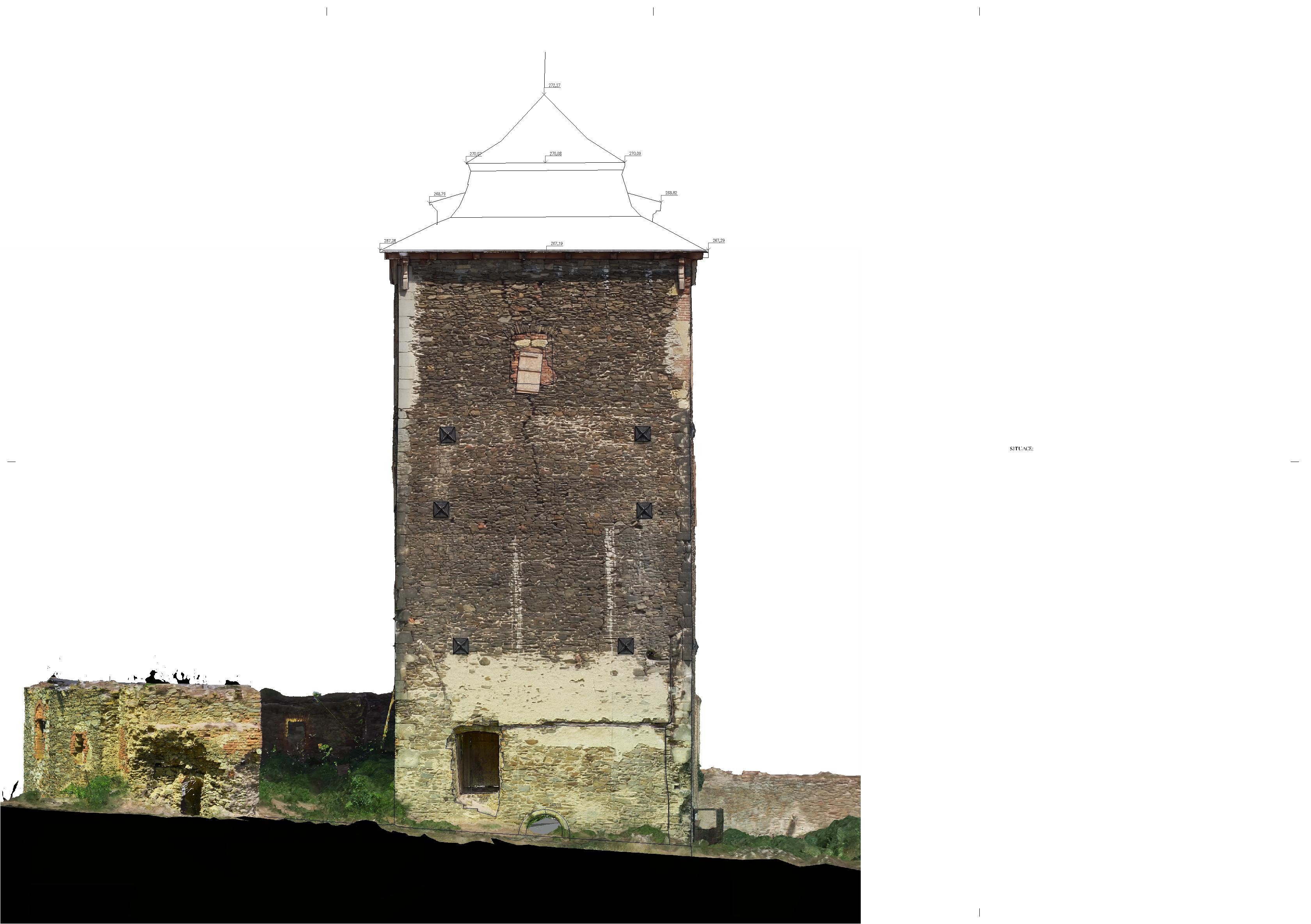
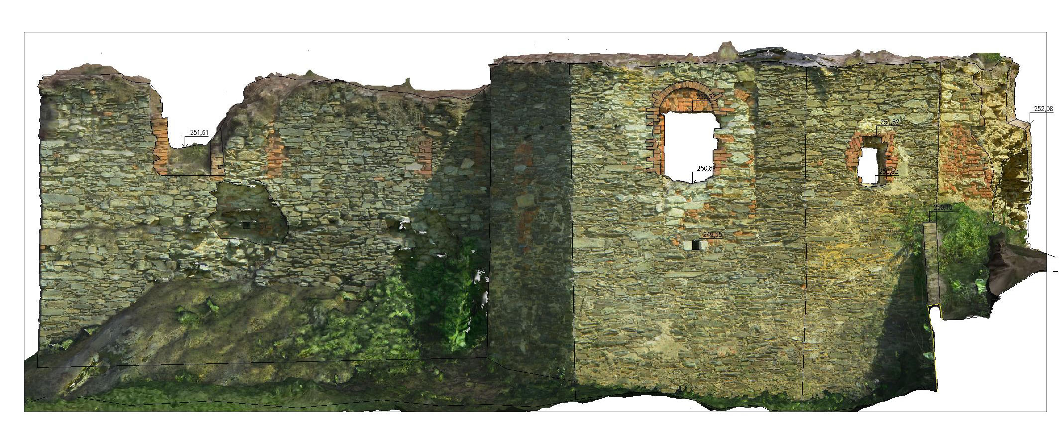
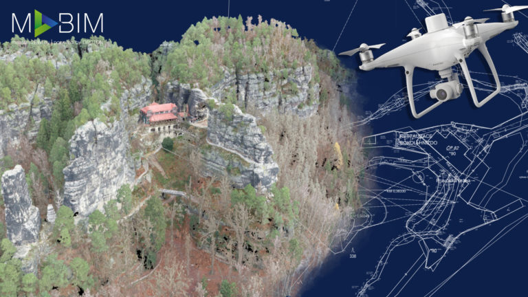
CAD Project: Hradenin Fortress
Hradenin Fortress is located in the Central Bohemian Region in the village of Hradenin. The current owner plans to restore the remains of this 14th-century fortification.
Due to the strict rules of conservation, extensive research was needed to comprehensively record the remnants of the existing structure.
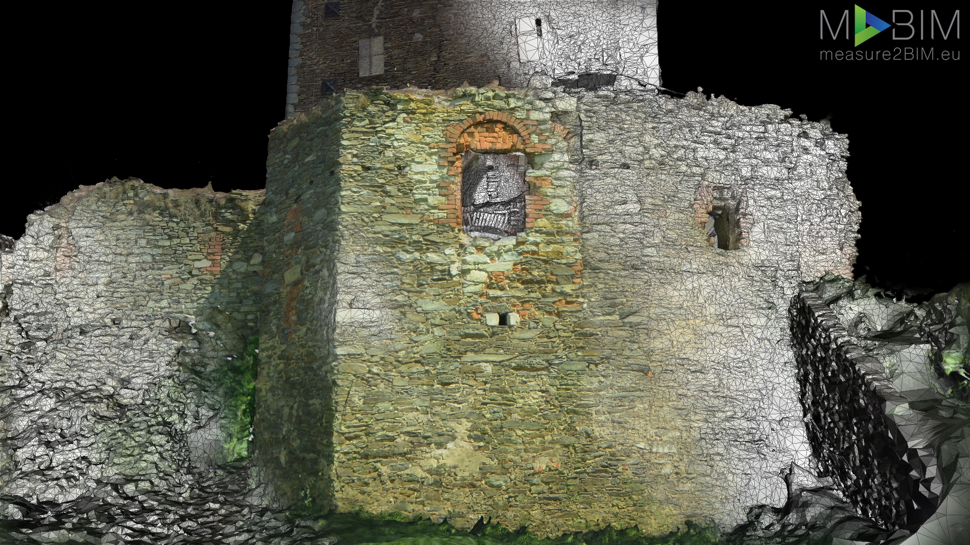
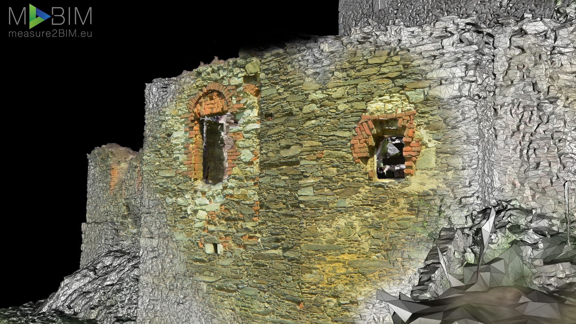
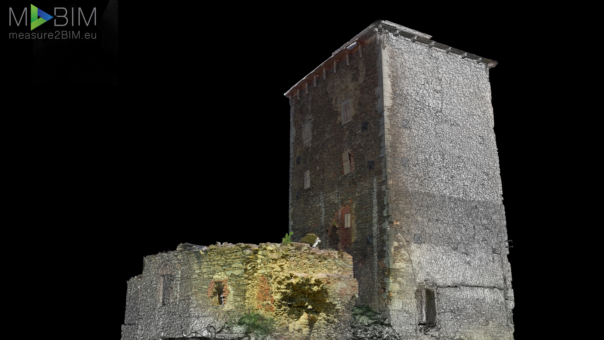
This project focused on using state-of-the-art technologies and techniques, such as terrestrial and aerial photogrammetry combined with 3D laser scanning
and classical geodetic methods. This made it possible to create a very accurate 3D textured model (accuracy to 5 mm), which was used to process construction documentation containing sections, floor plans and orthophoto views of individual facades.
This website uses cookies for analysis purposes. By using our website, we assume that you agree to our use of cookies.
You may revoke your consent for us to store cookies at any time by deleting the cookies. Revoking your consent does not affect the legality of any processing performed on the basis of your consent prior to its revocation.I acceptDeclinePrivacy policy