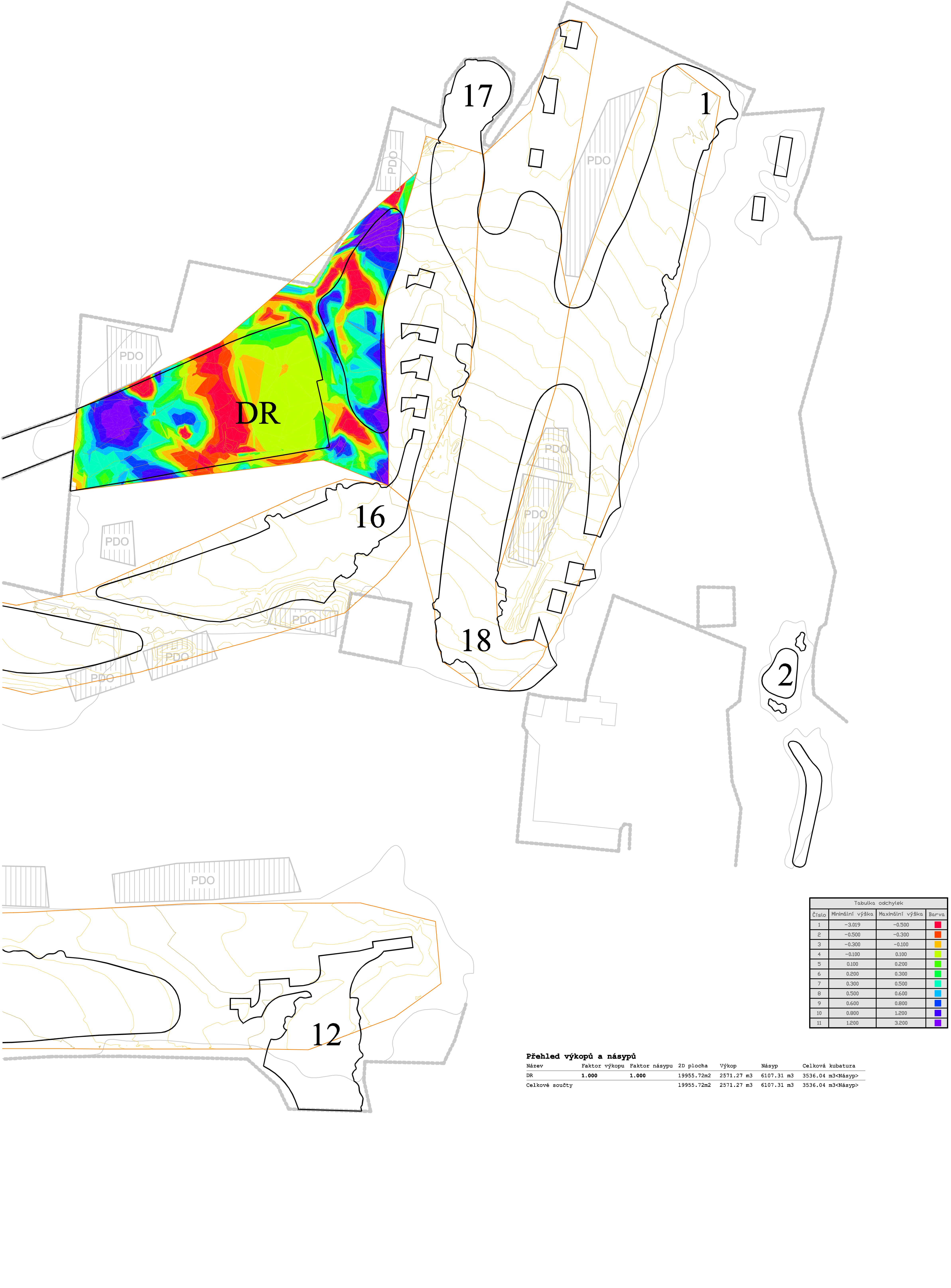
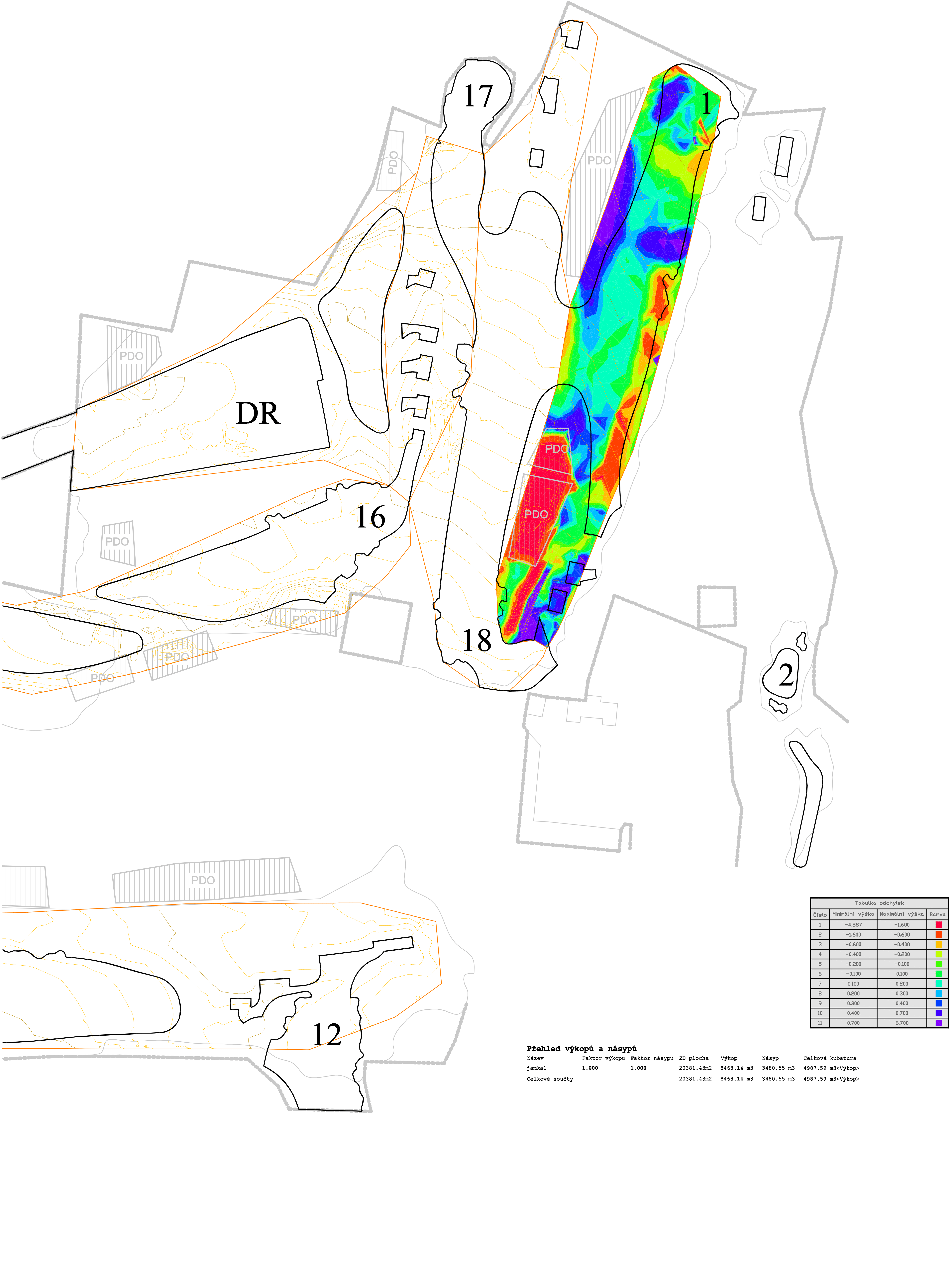
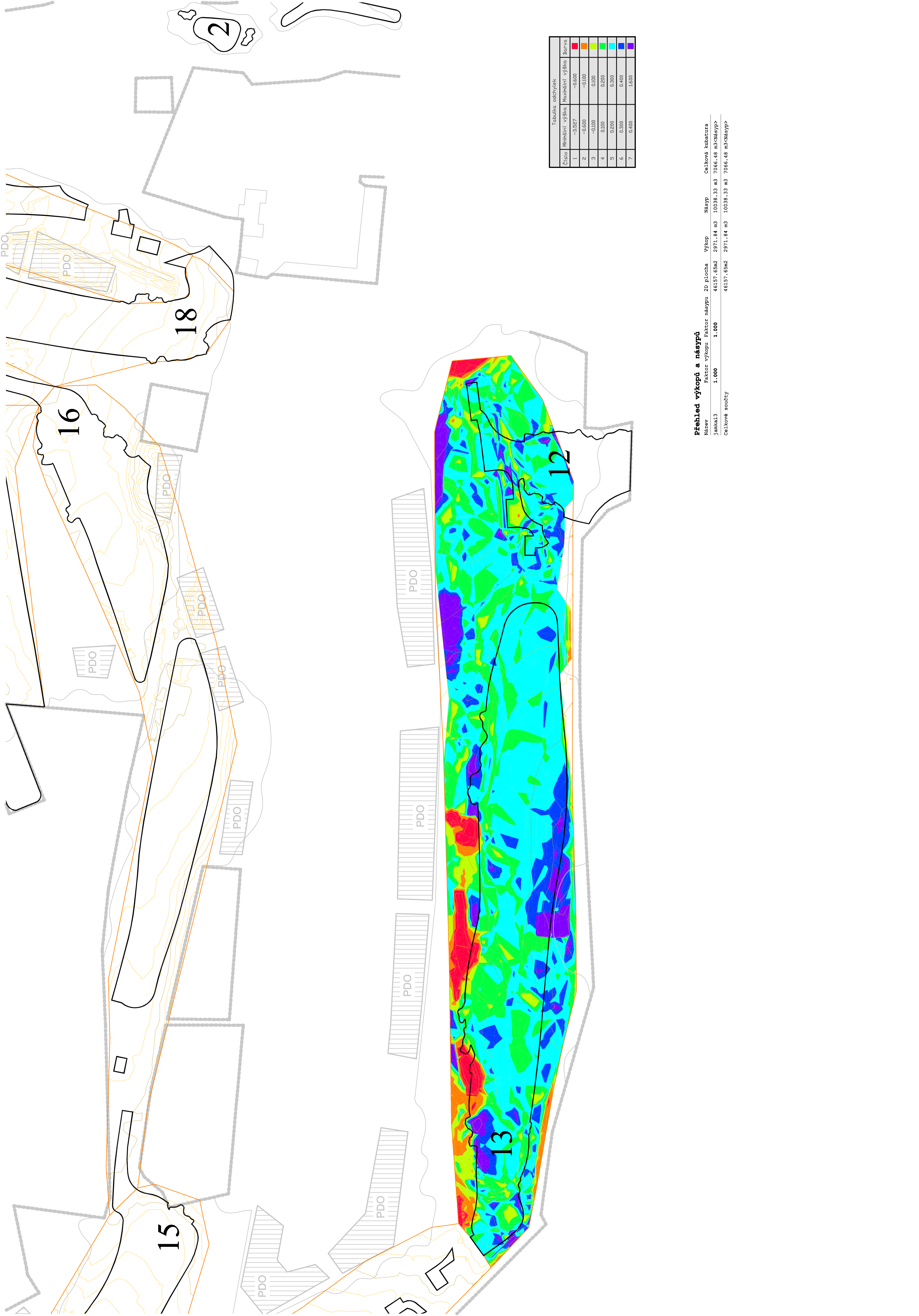
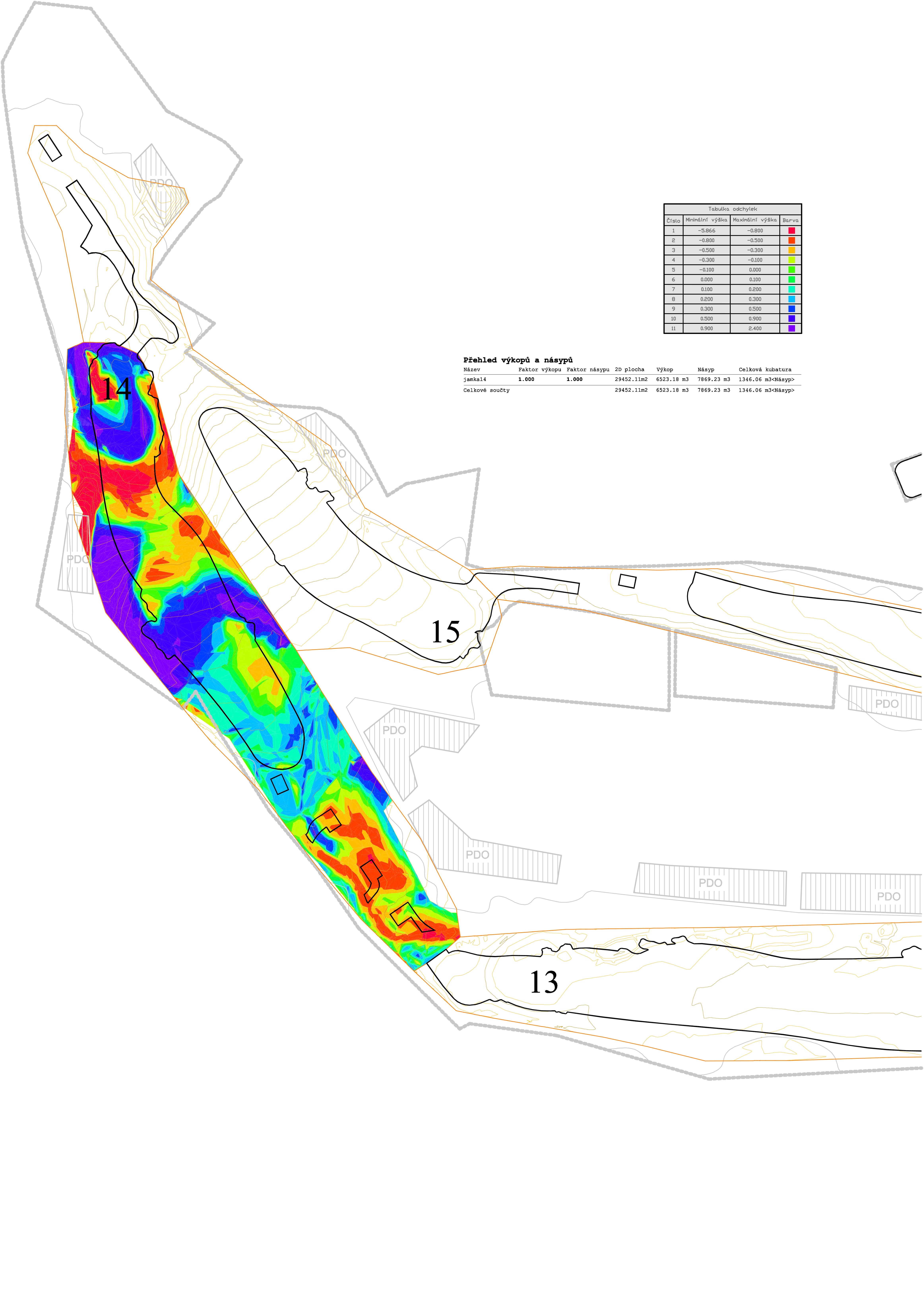
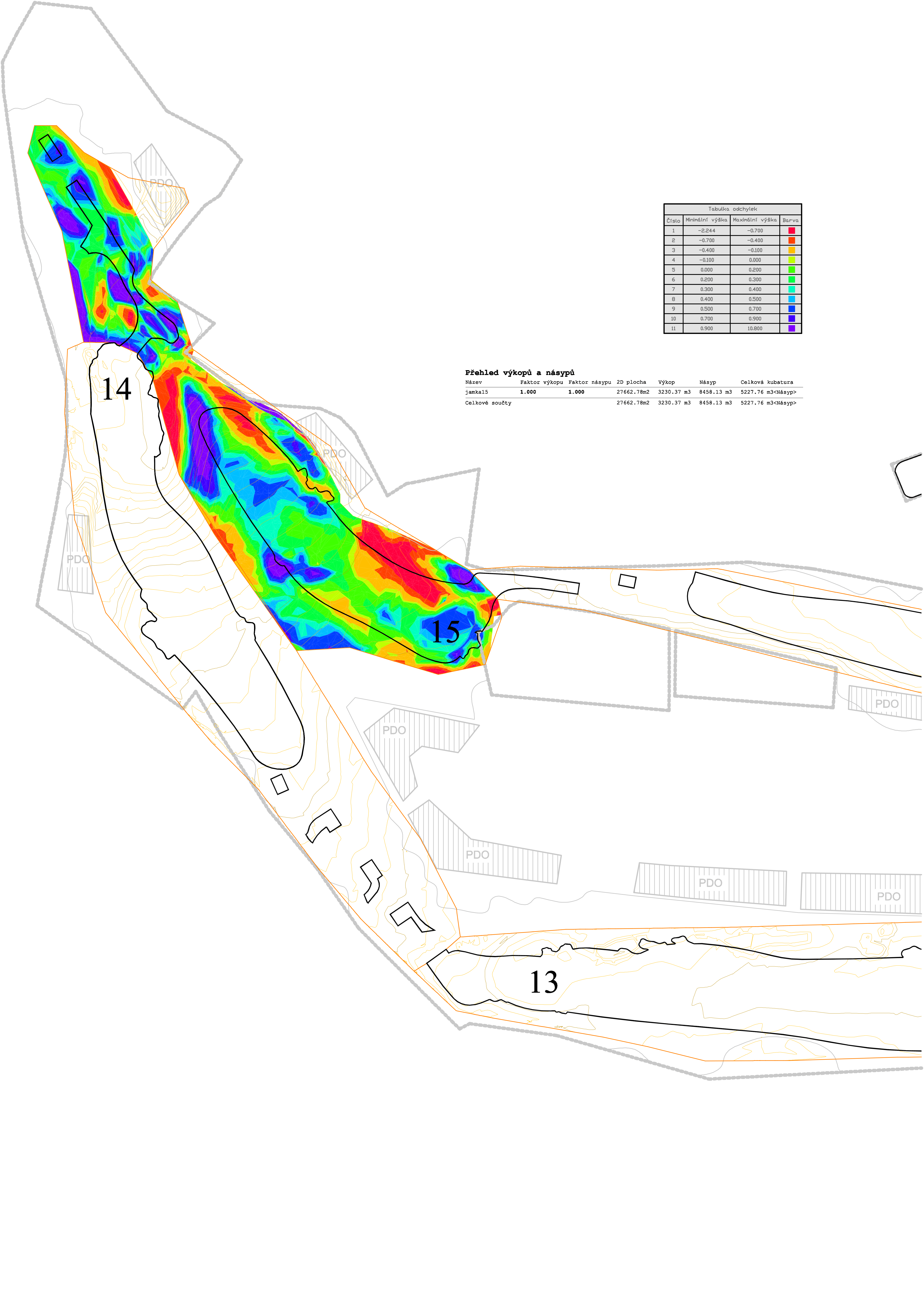
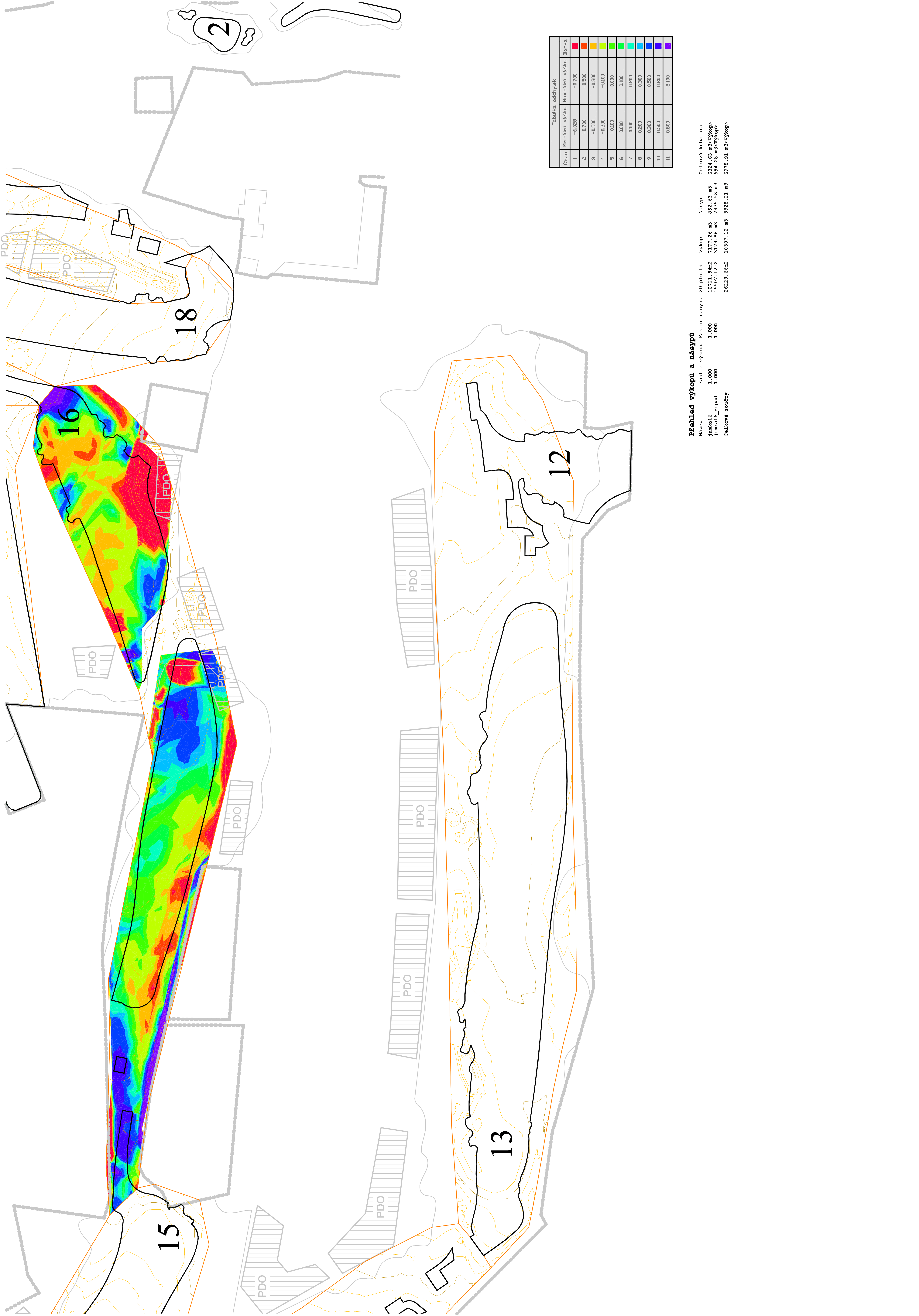
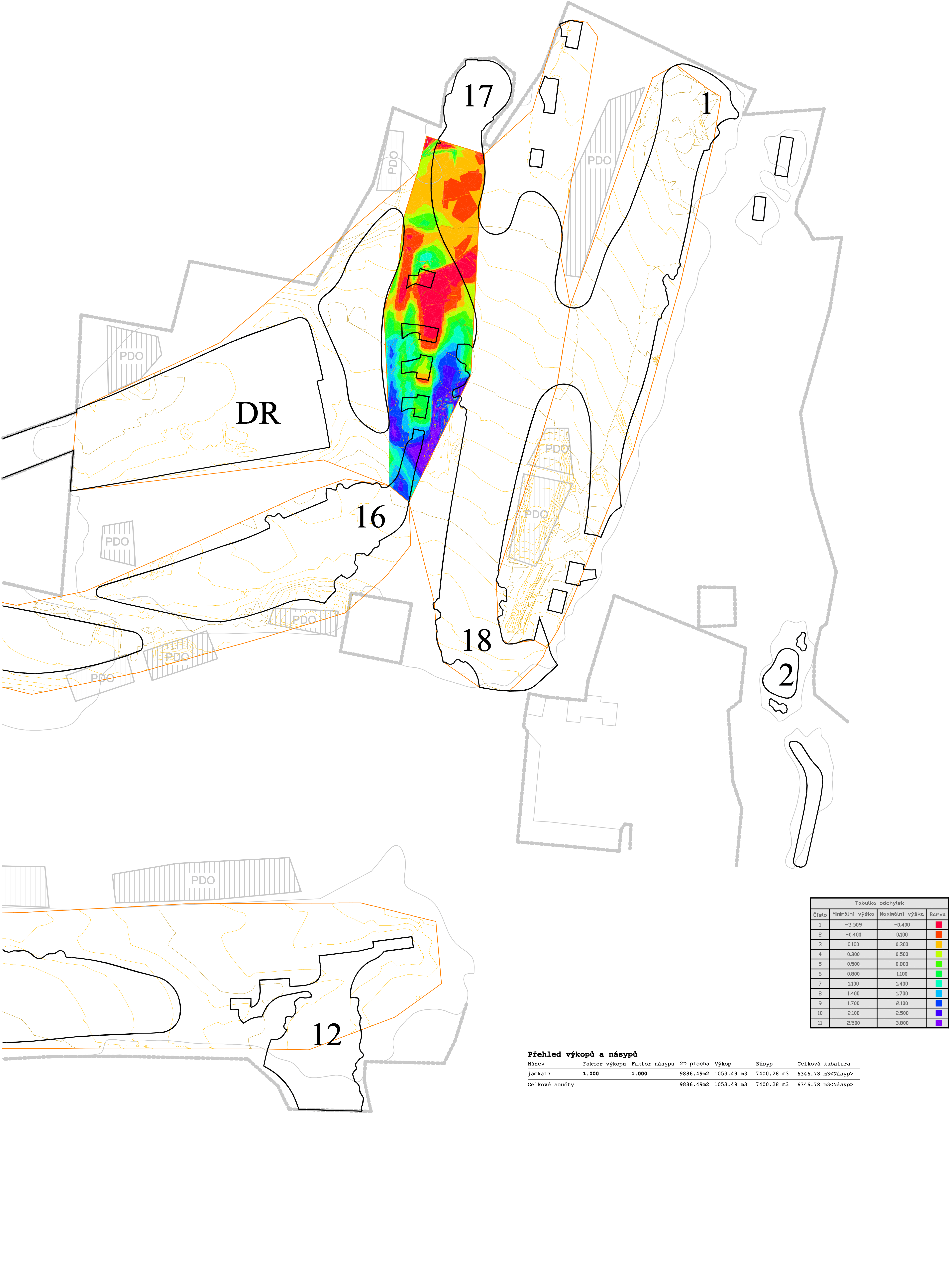
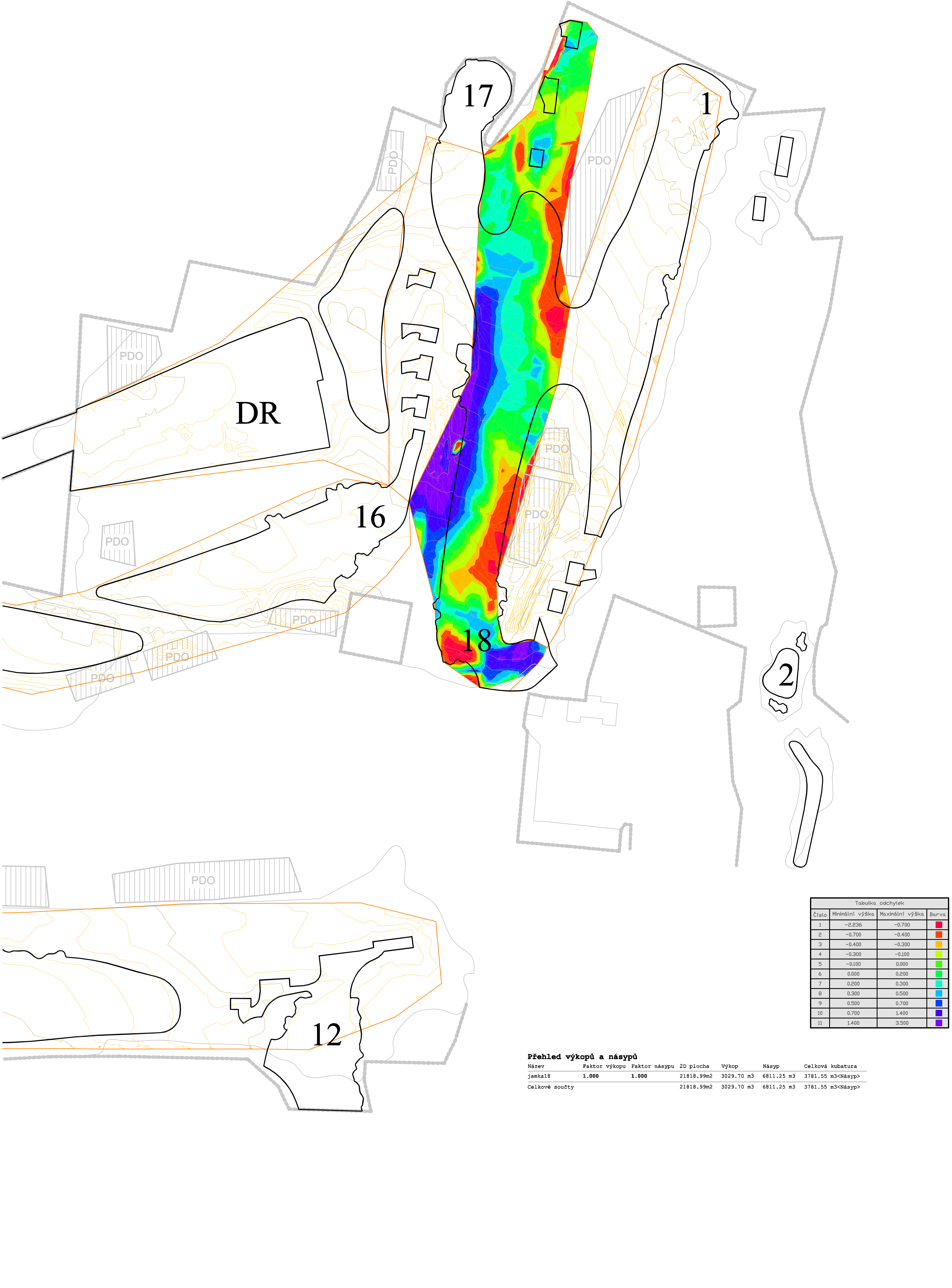
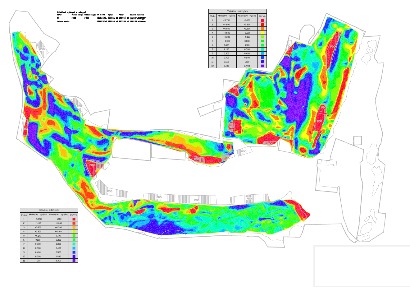
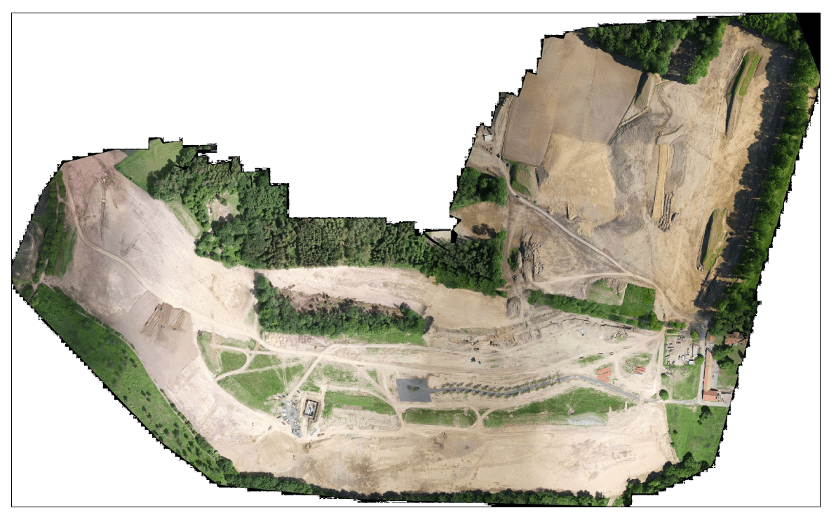
This was the basis for the construction of the Golf Resort in Nebřenice. The survey of the golf course was conducted after the completion of the rough grading. The output was a detailed 3D model of the existing terrain, including a project comparison and a calculation of cubic capacity. The survey was made using a professional UAS (Unmanned Aircraft System) with a very accurate RTK (Real-Time Kinematic) antenna, which enabled the creation of a 3D terrain model with the accuracy down to centimetres.
This website uses cookies for analysis purposes. By using our website, we assume that you agree to our use of cookies.
You may revoke your consent for us to store cookies at any time by deleting the cookies. Revoking your consent does not affect the legality of any processing performed on the basis of your consent prior to its revocation.