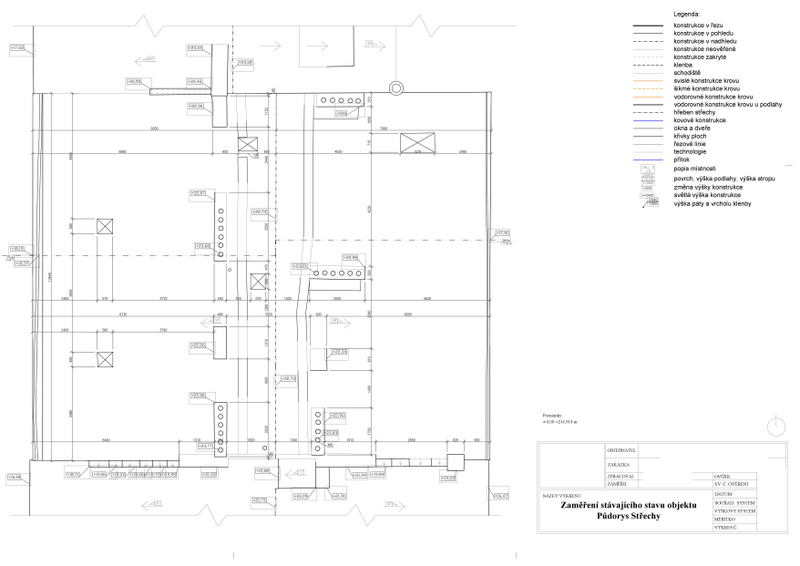
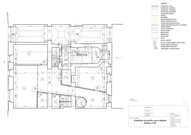
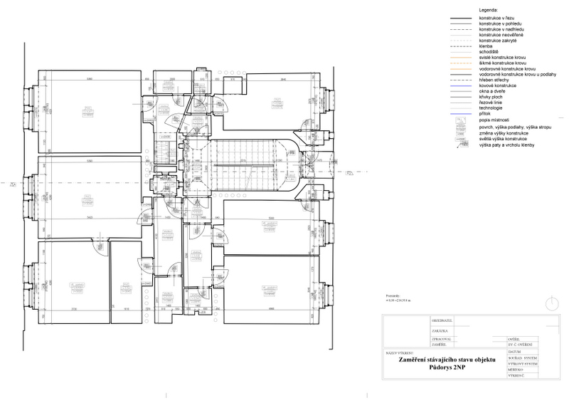
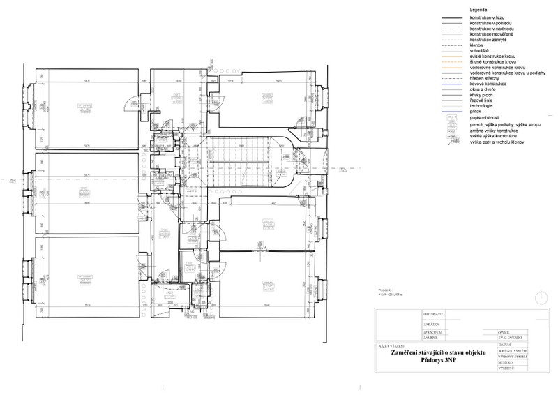
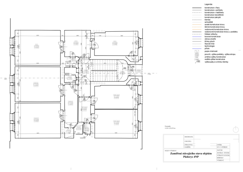
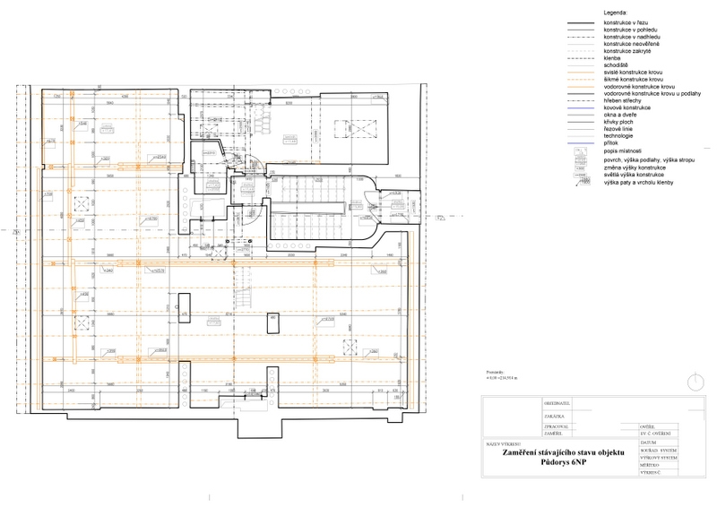
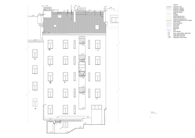
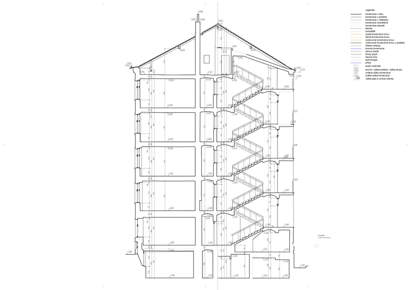
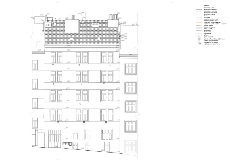
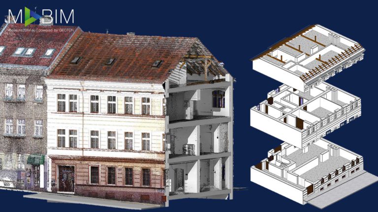
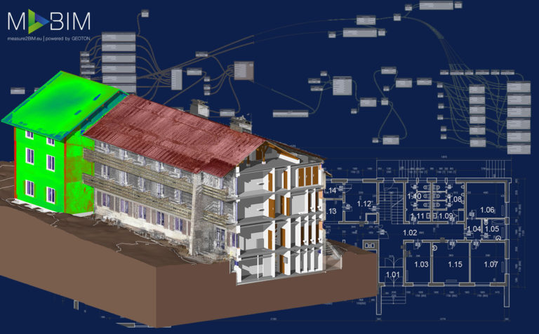
The block of flats in Na Kovárně Street was surveyed during full operation, and in a single day. The survey was performed using ground and aerial photogrammetry in combination with 3D laser scanning and classic geodetic methods. This made it possible to create a highly accurate 3D model in the form of a point cloud, which was used to process complete As-Built CAD documentation containing sectional views, floor plans and views of individual facades. The documentation was prepared in LOD2 at the client’s request and served for the building’s complete reconstruction.
This website uses cookies for analysis purposes. By using our website, we assume that you agree to our use of cookies.
You may revoke your consent for us to store cookies at any time by deleting the cookies. Revoking your consent does not affect the legality of any processing performed on the basis of your consent prior to its revocation.I acceptDeclinePrivacy policy